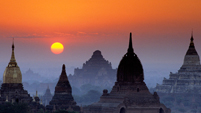


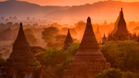


Myanmar Topography
 Myanmar terrain is lowering from north to south, mountains and plateaus in the north and plains in the south. Myanmar's main geographical features can be divided into four categories: highlands in the east, mountains in the west, plains in the central and coastal in Rakhine.
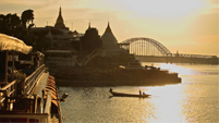
Four largest rivers are Ayeyarwaddy, Thalwin, Chindwin and Sittaung. Ayeyarwaddy River is considered as the lifeblood of Myanmar people with a length of 1238 miles.
You might also like ...

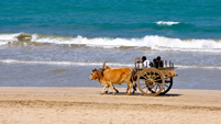
Myanmar Geography
Myanmar is located on the western part of the Indochina Peninsula in Southeast Asia between 9°32' to 28°31'north latitude and 101°11' east longitude. Myanmar is the second largest country in...

Myanmar Climate
Myanmar is a tropical climate country with three distinct seasons, summer also known as hot, rainy and cool season. Summer starts from March to mid-May, the rainy season begins from mid-May to...

Myanmar History
Myanmar civilization is marked from the first century with the archaeological site which is found from the time of the kingdom Thayekhittaya, Beithano and Hanlin.

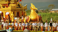
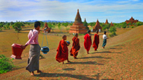
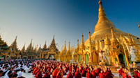
Myanmar - A heritage land of Buddha
More than 80% of Myanmar population follows Theravada Buddhism. Monks can eat like civilians, but not killing and eating after 12 noon. Early in the morning, each group of clergy in yellow or brown...
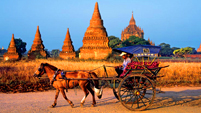
Myanmar Travel Guide
Newsletter
Myanmar Tour Packages
- Top 10 Myanmar Tours
- Myanmar New Tours
- Myanmar Classic Tours
- Myanmar Beach Tours
- Myanmar Adventure Tours
- Myanmar Bird Watching Tours
- Myanmar Festival Tours
- Myanmar Cuisine Tours
- Myanmar Cruise Tours
- Myanmar Golf Tours
- Myanmar Honeymoon Tours
- Myanmar Elephant Tours
- Myanmar Luxury Tours
- Myanmar Balloon Tours
- Myanmar Multi-Country Tours